
Geospatial data integration, conversion and management
InTouch can source maps and other digital data, convert field survey data into useable information, integrate data between database, spreadsheet and GIS formats or manage very large complex datasets.
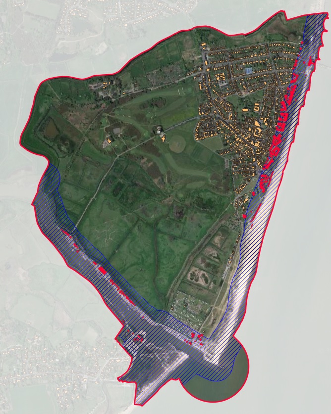
Spatial Analysis
InTouch offers comprehensive spatial analysis of your datasets. Whether its for site selection, travel time analysis, population distribution or ecological mapping, InTouch can provide the answers to “Where is..?” “How far..?” “What is the best location for..?”

Map production
High Quality cartographic output can be produced to your specification. Making the most of free, commercially available and bespoke geographic information, InTouch can produce maps suitable for reports, display or electronic distribution.

Web Mapping and Story Maps
Interactive web maps and content rich story maps can be created to your own specification. Web maps bring in your own spatial data with the wealth of information publicly gives content rich maps. Storymaps combine interactive mapping with informative text, pictures and video to really engage the viewer in the information provided.

Bespoke training in ArcGIS and QGIS Software
InTouch offers bespoke training on using GIS software for your day to day purposes. Identifying what you need to know to do your job, InTouch will guide you through the technical background, functions and processes that will help you get the most out of your GIS software
